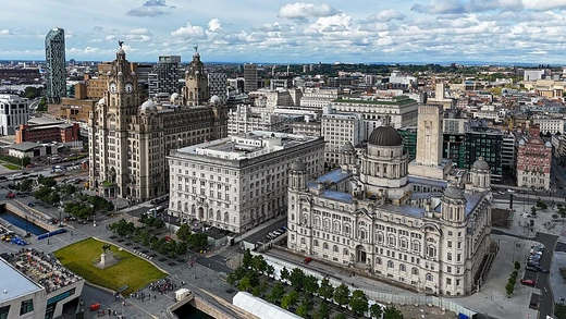
Amarah
City in southeastern Iraq, seat of Maysan Province.

Dr. Alexey Yakovlev · CC BY-SA 2.0
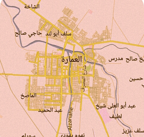
Amarah (Arabic: ٱلْعَمَارَة, romanized: al-ʿAmārah), also spelled Amara, is a city in south-eastern Iraq, located on a low ridge next to the Tigris River waterway south of Baghdad about 150 km (93 mi) from the nearest point of the Iran–Iraq border. It lies at the northern tip of the marshlands between the Tigris and Euphrates. Founded in the 1860s as an Ottoman military outpost, Amarah is the seat of the Maysan Province and a major trading center for the surrounding agricultural area, known for woven goods and silverware.
- Founded
- 1860s
- Province
- Maysan
- Known for
- woven goods, silverware, winter cereals, sheep, horses
- Climate
- hot desert climate (Köppen BWh)
Lore & Background
The city was founded in the 1860s as an Ottoman military outpost from which the empire tried to control the warring Banu Lam and Al Bu Muhammad tribes. During the eight-year Iran–Iraq War, the eastern parts of the province became the site of several battles, notably Operation Before the Dawn launched by Iran. After the Persian Gulf War, Amarah was one of many sites during the 1991 uprisings in Iraq against Saddam Hussein. Following the uprising, a mass grave was discovered outside the city, primarily containing Shiite rebels and army deserters killed by government forces. The draining of the Mesopotamian Marshes was a larger-scale project affecting areas south of Amarah, not specifically the marshes surrounding the city, and the dams were primarily on the Tigris and Euphrates rivers upstream. Throughout the 1990s, the town's population swelled with refugees from the marshes. In 2003, it was occupied by British forces. After the British handed power over to the Iraqi government, a power struggle erupted between Shi'ite loyalists of the Mahdi Army and Badr Brigades.
Reader's Guide
Amarah's significance lies in its strategic location near the Iranian border and its role as a center of resistance and conflict across multiple eras of modern Iraqi history. Founded as an Ottoman outpost to control local tribes, it later became a site of British occupation, a feudal stronghold, and a flashpoint during the Iran–Iraq War, the 1991 uprisings, and the Iraq War. Amarah remains a key agricultural and trading hub, producing woven goods, silverware, and staple crops.
Did You Know?
- Amarah was founded in the 1860s as an Ottoman military outpost to control the Banu Lam and Al Bu Muhammad tribes.
The Garrison in Isolation
The force holding CIMIC House was a modest, composite garrison drawn from several regiments. Two troops of A Squadron, Queen's Royal Lancers, fewer than ninety soldiers of Y Company, 1st Battalion, the Princess of Wales's Royal Regiment (reinforced by a substantial contingent of Territorial Army personnel from the 52nd Lowland Regiment who had mobilised to serve alongside the QRL and PWRR battle groups), and sixty Royal Welch Fusiliers made up the defenders. All belonged to the 1st Mechanised Brigade deployed under Operation TELIC IV. Their position was made especially precarious by geography: the compound sat roughly twenty miles from the main Battle Group at Abu Naji, meaning every resupply depended on convoys threading through hostile territory. The building itself had a loaded history, having previously served as the residence of the Ba'ath Party governor of Maysan province before being repurposed as the British Army-led Multi-National Division (South-East) hub for Civil-Military Co-operation activities in Al Amarah.
Twenty-Three Days Under Fire
Over the ensuing twenty-three days the garrison absorbed eighty-six separate ground assaults, scaling from small section-strength probes to company-level waves of more than a hundred fighters. During the peak window between 5 and 25 August the tempo was so intense that armoured supply convoys could no longer reach the compound. Yet despite the ferocity, not a single infantry wave penetrated within thirty metres of the British defensive lines. Y Company, 1 PWRR, based at CIMIC House, recorded the highest attack count of any company across the entire Iraqi theatre of operations.
Command and Firepower Under Pressure
Commanding officer Major Justin Featherstone was granted explicit permission by his superior to withdraw the garrison if conditions on the ground warranted it. He declined to pull his men from their posts. For a six-day interval, Captain Charlie Curry assumed command while Featherstone was on rest and recuperation. The defenders answered with overwhelming volume: thirty-three thousand rounds were discharged, supported by fire from Challenger 2 tanks, Warrior armoured vehicles, and 81 mm high-explosive mortar shells. Reinforcement came from B Company and C Company of 1 PWRR at Camp Abu Naji, whose armoured infantry fought numerous street-level engagements with Mahdi Army fighters throughout Al Amarah, while Territorial Army elements including a Warrior AFV from B Company, Black Watch, snipers from 1st Battalion, 22nd Cheshire Regiment, and Royal Yeomanry squadrons added to the defensive screen.
Cost, Consequence, and Historical Standing
The human toll on the British side was, in terms of fatalities, singular but deeply tragic. Private Chris Rayment was the only soldier killed; his death resulted when a traffic barrier fell on his head after its linkage was snagged by a Snatch Land Rover entering the camp under heavy enemy fire during a convoy. Six other British soldiers sustained serious injuries. British estimates placed Mahdi Army casualties at more than two hundred dead, a figure that left the militia a severely depleted force in Al Amarah, incapable of mounting large-scale attacks against coalition positions for the remainder of the occupation. In Sergeant Dan Mill's memoir Sniper One, the defence was characterised as the longest continuous action the British Army had fought since the Korean War, and as the lengthiest defensive stand since the Second World War.
Gallery

Frequently Asked Questions
What is Amarah?
Amarah is a city in south-eastern Iraq perched on a low ridge beside the Tigris River, sitting at the northern edge of the Tigris-Euphrates marshlands. It acts as the provincial capital of Maysan and lies roughly 150 km from the closest stretch of the Iran–Iraq border.
When and why was Amarah founded?
The settlement traces its origins to the 1860s, when the Ottoman Empire established it as a military outpost. It gradually expanded from that garrison base into a permanent civilian and commercial town.
What is Amarah known for?
The city is a well-known trading hub for the surrounding farmland, with local industries centered on woven textiles, silverware, winter cereals, sheep, and horses. Its position near the river and marshlands has long supported agriculture and livestock trade.
What is the climate like in Amarah?
Amarah sits in a hot desert climate zone (Köppen BWh), so residents deal with extremely high summer temperatures and very little annual rainfall. Winters are comparatively mild but still arid.
What province does Amarah serve as the capital of?
Amarah is the administrative seat of Maysan Province in southeastern Iraq. As the provincial capital, it houses the regional government offices and serves as the main urban center for the area.
More in Miscellaneous Cities 1-22
Spotted an error? Know more?
This is a living reference — every entry is fact-audited, and reader corrections feed straight into our audit queue. Suggest an edit · See this site's audit record